Carnegie - the debris flow volcano
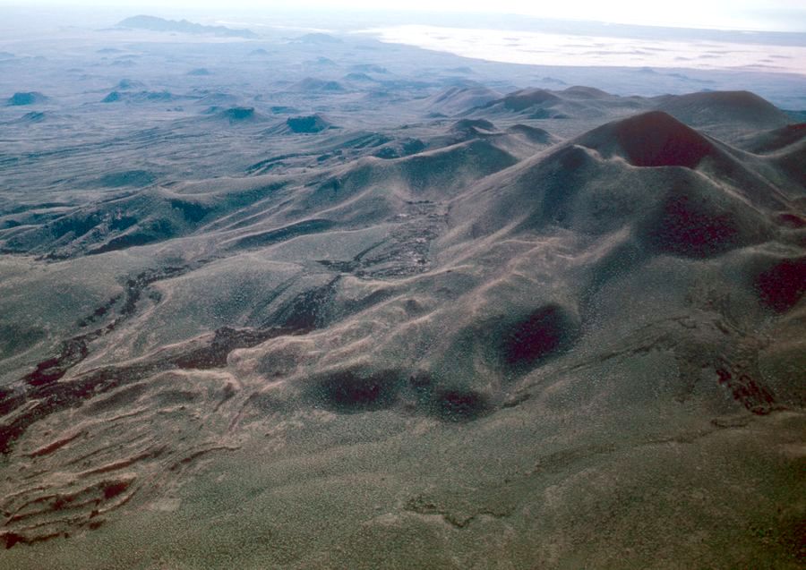
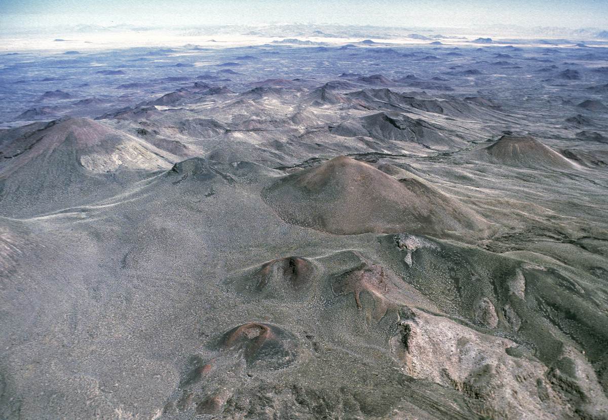
Carnegie Cone is noteworthy because of its large debris flow and because early lava flows differ so markedly in appearance from the late lavas. The two lava flows pictured above, one with cinder and the other without, are the longest in Pinacate because both were able to extend nearly 15 km after they got into a stream channel cut into lower Santa Clara and were protected from heat loss. Although Carnegie erupted nearly 40 thousand years ago, erosion is minor and found in only a few places. The eruption appears to be the source of an irregular cinder blanket that covers Santa Clara's upper slopes. The cone is named for Andrew Carnegie, benefactor of the Carnegie Desert Laboratory in Tucson where the 1907 Hornaday expedition to Pinacate originated (Hornaday, 1908, Campfires on Desert and Lava).
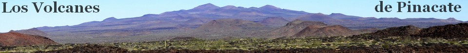
Summit Platform
Carnegie sits on the northeastern edge of the Santa Clara summit platform, a roughly oval area above 900 m elevation. This high land contains half a dozen younger Pinacate cones and some eroded older cone remnants (including Pinacate Peak) in a topography developed on Santa Clara trachyte, the most evolved of the Santa Clara alkaline rock series. Everything here is blanketed with cinder from Carnegie.A dreadful FlashEarth snapshot shows the best example of erosion and is explained in image 4 in the gallery. FlashEarth is a Microsoft version of Google Earth; the images are higher resolution but the tone range is so extremely short that major processing of captured images is necessary to show detail.
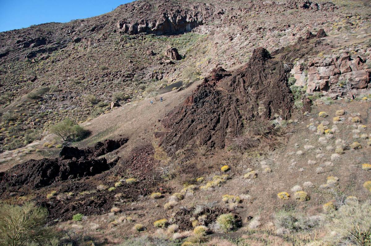
The cone wall collapsed
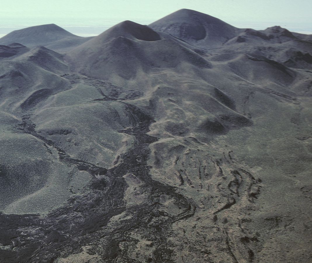
Debris of the collapsed north wall seems to have ridden atop the lava flow beneath it, both are covered with airfall cinder. This lava flow, its source hidden from sight, probably preceded building of the pyroclastic cone and became an unstable base on a hillside when the wall scoria was dumped on it. That scoria was not welded as it is today but was mobile and when the weight of the growing wall reached some threshold, the bottom slid out and the scoria cascaded down the flank of the mountain nearly a kilometer. The entire north half of the cone split away from the south as it broke-up. The pyroclastic phase continued after the collapse event and the north cone wall was partially rebuilt in the gap.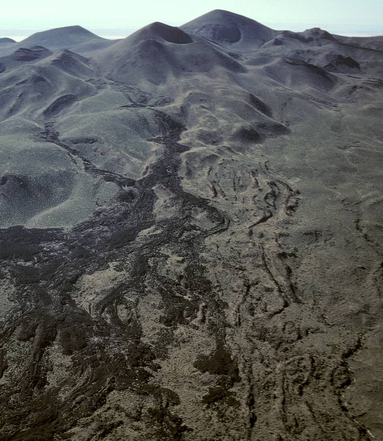
Gray lavas
The distinction between the two generations of Carnegie lavas is striking in all of the images from the base of the cone to the far desert flat. This is highly unusual and has not been observed at other Pinacate volcanoes. Tecolote, another of the extraordinary volcanoes, has seven flows showing wildly different viscosity behaviors but the difference in appearance is not as great.Absent geochemical evidence, there is a possibility that the gray lavas are older than Carnegie and from a different source, perhaps Bonillas. That would make the explanation of Carnegie's collapse difficult at best. Wait for Jim, I guess.
Black-brown lavas
Magma issued from two places a kilometer apart along a N80W fissure east of Carnegie. Both boccas are decorated with spatter cones. Flowing liquid coalesced south of Red Cone and tumbled into the arroyo that had previously been used by the gray lava, following it down onto the desert to similarly spread out. The Iitoii's Cave section in the valley at the cone's base has several lava tube caves including one that was formerly a holy place for the indigenous O'odham. This flow was of sufficiently low viscosity that pahoehoe textures are common all the way down to the piedmont at Red Cone albeit mixed with aa textures. The lava fall was steep in several places next to the debris flow.Across the cone from the Iitoii bocca, across the center of the crater, is the buried bocca of the West flow. The line is N60W, not on strike with the east fissure. This flow also traveled in an arroyo.